
Bali is full of places labeled as “must-see.” Mount Agung is one of them—but while for travelers it’s mainly a tempting peak calling to be conquered, for locals it holds a completely different meaning. It’s a mountain deeply respected by the Balinese, forming one of the main pillars of their religion as well as their overall sense of direction and orientation in life.
Why Mount Agung Is Worth Visiting
Mount Agung rises to 3,031 meters above sea level, making it the highest mountain in Bali. It’s also an active volcano that still occasionally reminds people of its power.
At first glance, Agung might not look as dramatic as some other volcanoes in Indonesia, but the hike is more demanding than many expect. Technically, it’s not the most difficult climb, yet physically it can be surprisingly challenging.
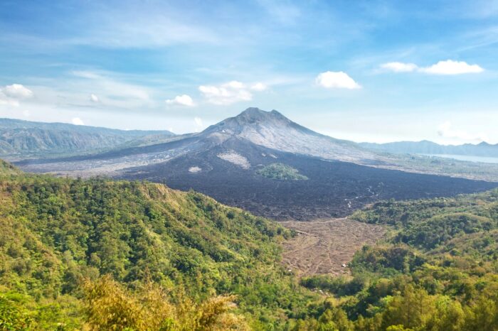
One thing that makes Agung stand out is that it’s usually less crowded than some of Indonesia’s more famous volcano hikes. With the right timing and route choice, there’s a good chance you’ll spend large parts of the trek with very few people around.
At the same time, this isn’t just another mountain in Bali. Agung holds deep spiritual importance for the island, and you can feel that atmosphere throughout the climb. Reaching the summit is part of the experience, but so is understanding the significance this mountain has for local people.
The Sacredness of the Volcano
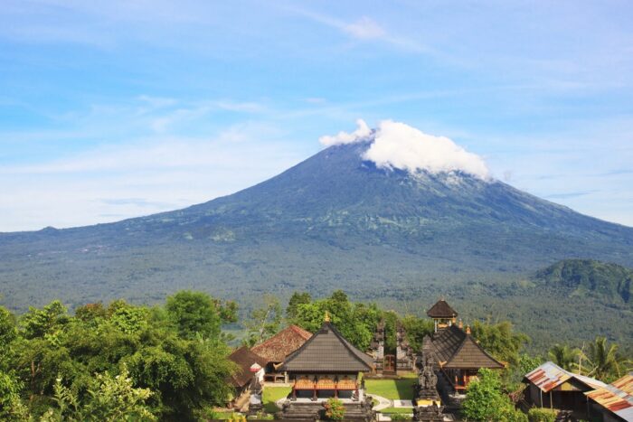
For the Balinese, Mount Agung is a sacred mountain. In Balinese cosmology, it represents the axis of the world and the dwelling place of the gods. This belief isn’t just symbolic—it’s still very present in everyday life on the island.
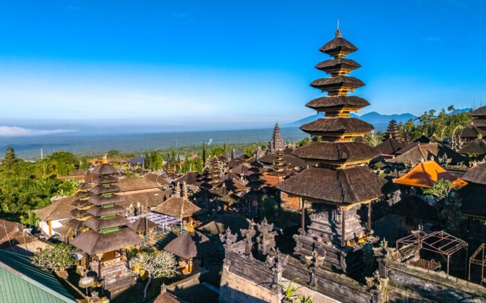
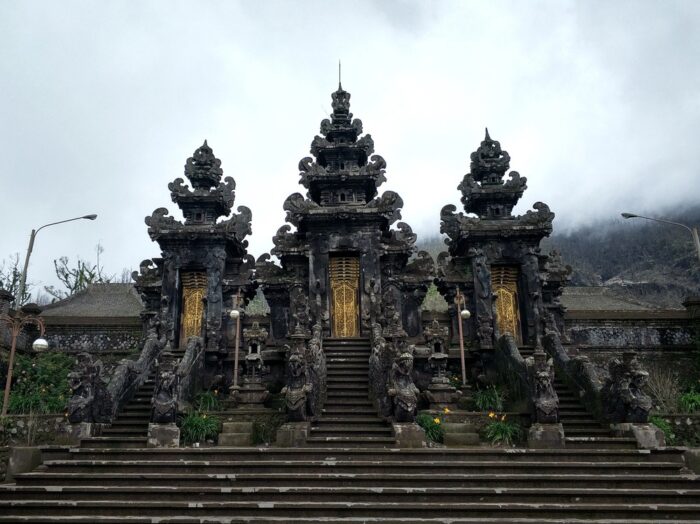
You can even see its influence in local architecture, as traditional houses and temples are oriented toward the mountain. Bali’s most important temple, Besakih, sits directly on its slopes, and one of the main trekking routes to the summit starts from here.
This gives the climb a different meaning. It’s not only about the physical challenge or the views from the top. At the start of the hike, you may witness a short ritual, where the guide prepares offerings, lights incense, and says a brief prayer. It doesn’t happen every time and depends on the guide, but when it does, it feels like a natural part of the experience—and a reminder that Agung is approached with respect.
What to Avoid
Because Mount Agung is sacred, there are a few basic rules worth keeping in mind—not just for safety, but also out of respect for local people and their religion.
If ceremonies are taking place on the mountain, don’t try to hike up anyway just because you’re short on time.
Likewise, don’t try to bend the rules by heading up without a guide or ignoring current warnings about volcanic activity—even if the volcano seems “calm.”
Also avoid entering sacred areas, posing in revealing clothing, or behaving in a way that feels out of place here—such as drinking alcohol at the summit or shouting.
And of course, respect the nature around you: don’t damage anything and never leave trash behind.
Starting Points & Hiking Routes
Mount Agung is located in the eastern part of Bali, which is generally quieter and less touristy than the south of the island. There are several starting points for the trek, with the most common ones being from Besakih Temple or Pasar Agung Temple.
Pura Besakih Route
This is the classic and most well-known route, leading all the way to the highest summit of Agung. It’s also the most commonly used option, even though it’s relatively long.
The climb is lengthy and physically demanding, but not technically difficult. The terrain gradually shifts from forest sections to more open areas with rocky ground and loose volcanic sand, which can become quite challenging in the upper sections.
Along the way, you’ll pass several landmarks and resting spots, with a few places where hikers can even spend the night if needed. Overall, this route makes the most sense if you want to reach the true summit and don’t mind a longer, more demanding ascent.
Backindo Tip: This temple is worth visiting on its own, but it also fits well into a longer day trip with other nearby sights.
Pura Pasar Agung Route
The second most common route starts from Pasar Agung Temple in the Sebudi area (around 1,000 meters above sea level).
Compared to the Besakih route, this climb is significantly shorter—usually around 4 hours—but it’s also steeper and more physically demanding. The trail gets steep almost immediately and soon turns into rocky, loose terrain. Early on, you’ll also face several hundred steps, which can be especially tricky after rain when they become slippery.
As you gain elevation, the climb becomes more direct and the difficulty increases. This route usually ends at the crater rim, rather than the true highest point of Mount Agung. Even so, the views are beautiful, and for many hikers, this route offers a good balance between effort and time.
If you want to continue to the true summit, it is possible—but you’ll need to add roughly 1–1.5 hours from the crater rim. The turnoff for this section is around 2,400 meters above sea level.
Alternative Routes
Besides these two main routes, there are several lesser-known options. These include routes via Pucang, Kedampal, Pura Pengubengan, or various local trekking paths used by guides from nearby communities.
For example, the Pucang route starts at around 900 meters above sea level and heads toward the western summit of Agung, from where it’s only a short stretch to the main peak.
On the other hand, the Kedampal route leads to the eastern rim of the crater (around 2,940 meters above sea level) and usually ends there—continuing to the summit is not commonly done, as it would require an unnecessarily complicated detour.
Backindo Tip: Alternative routes are not always officially open and often pass through private or community land. Always check the current situation, arrange permission if needed, and go with a local guide.
How to Get To Mount Agung
Mount Agung is located in the eastern part of Bali. From Denpasar, it’s about 60 kilometers to the area. Since most climbs start at night, it makes sense to stay as close as possible. Ideal areas include Sidemen or Tembuku. Some travelers also choose Ubud, but in that case, you should expect a journey of around 1.5–2 hours.
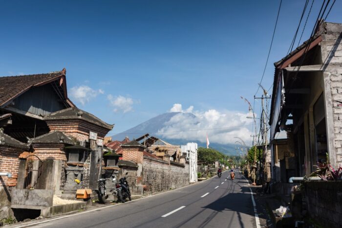
The easiest option is to arrange a pickup directly from your accommodation with your guide. This way, you avoid the stress of transportation—just hop in and let yourself be taken to the starting point.
Another option is to rent a scooter and make your own way to the trailhead, meeting your guide there. However, keep in mind that riding at night can be more challenging—navigation is harder, you’re likely to be tired, and carrying a backpack doesn’t make it particularly comfortable unless you have solid riding experience.
Thinking about riding a motorbike in Bali? Read Riding a Motorbike in Indonesia as a Tourist.
How the Ascent Works
The Mount Agung hike usually starts with a pickup from your accommodation, followed by a drive to the trailhead and a short registration. Most ascents begin around midnight, but the exact timing depends on the route, your pace, and whether you’re aiming for the true summit or just the crater rim on the Pura Pasar Agung route. The goal is to reach the top in time for sunrise.
From there, you’ll set off in the dark with your guide. Make sure you have a headlamp, enough water, and a few light snacks—breaks along the way are usually short.
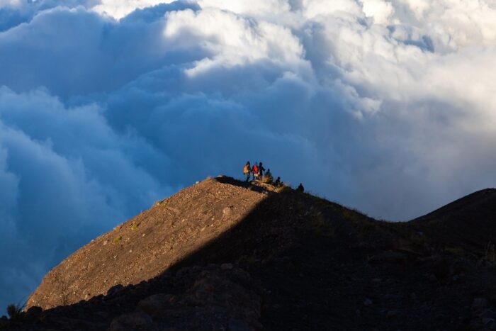
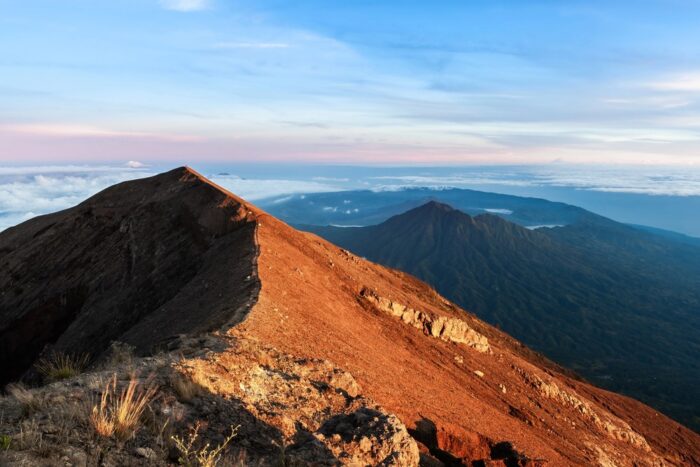
At the top, you’ll have time to rest and wait for the sunrise. If the weather is clear, you can see across Bali, with Mount Batur in the distance and sometimes even Mount Rinjani on Lombok.
Nikol has hiked several Indonesian volcanoes. You can read more about her experiences in the following guides: Rinjani (Lombok), Tambora (Sumbawa), Kerinci (Sumatra), and Kelimutu (Flores).
After sunrise, you’ll descend, usually along the same route. Don’t underestimate the way down—it can be tough on tired legs, especially on loose or rocky terrain. Most people return the same way, but it’s also possible to arrange an alternative route with your guide—for example, ascending from Besakih Temple and descending toward Pura Pasar Agung.
Once you’re back at the trailhead, your driver will take you back to your accommodation.
Eruptions in Recent Years
Mount Agung is an active volcano, and its activity has influenced tourism several times in recent years.
The most powerful eruption in modern history occurred in 1963—it lasted nearly a year and became one of the most significant Indonesian eruptions of the 20th century. It had tragic consequences, claiming more than a thousand lives and deeply impacting the entire island.
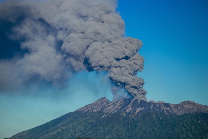
In more recent times, the volcano drew major attention again in 2017, when activity resumed. This led to evacuations in nearby areas, repeated closures of Bali’s airport, and restrictions on access to the mountain itself.
In recent years, access to Mount Agung has continued to change depending on volcanic activity. The mountain may not always be open for climbing, and conditions can shift quickly.
Backindo Tip: Before planning your hike, always check the latest updates and respect any restrictions in place.
Practical Information and Recommendations
The best time for the climb is during the dry season (May–September). During the rainy season, access is usually closed due to unpredictable weather, strong winds, and the risk of landslides. It typically reopens to the public at the end of April. Keep in mind that even in the dry season, the climb is not guaranteed, as mountain weather can change year-round.
What to Bring
- Sturdy footwear suitable for dusty volcanic terrain
- Clothing for both warm and cold conditions—don’t underestimate this, as nighttime temperatures can drop to around 8 °C
- A raincoat or waterproof jacket
- A headlamp, insect repellent, sunscreen, a basic first aid kit, plenty of water, and energy snacks
- A power bank
Backindo Tip: It’s important to confirm with your guide in advance whether food and water are included, or if you need to bring your own supplies.
Physical Difficulty
As mentioned above, the climb is not technically difficult, but it is physically demanding. If you’re not used to longer hikes or significant elevation gain, take it slow, pace yourself, and listen to your body.
It’s also worth repeating that Mount Agung is not Mount Batur. Many travelers compare the two because they’re both in Bali, but Agung is considerably harder—so don’t underestimate it just because you’ve already climbed Batur.
Costs and Permits
The cost of climbing Mount Agung varies depending on the route, season, and guide, but generally ranges between IDR 400,000 and 800,000 per group (USD ~25–50).
In some cases, the price may include transport from your accommodation, a headlamp, or simple refreshments, while in others these are charged separately. Always confirm in advance what’s included so you know exactly what to expect.
Unlike some other Indonesian volcanoes, Agung is not located within a national park, so there are no high entrance fees like those at Rinjani or Bromo. There is only a small local fee, currently around 50,000 IDR.
A local guide is mandatory here, and hiking without one is not recommended. In some cases, you may not be allowed to continue without a guide. It’s not just about safety and navigation, but also about respecting local rules and the mountain itself.
Where to Stay Before the Hike to Mount Agung
We recommend staying close to the starting point, ideally in areas like Sidemen or Tembuku. For budget accommodation, House Market near the Sidemen market is a great option. If you’re looking to treat yourself to a higher level of comfort and privacy, you’ll likely enjoy Pondok Wisata Patal Kikian. A solid mid-range choice is Abian Ayu Hotel.
If you decide to stay in more touristy areas like Ubud or Sanur, keep in mind that you’ll need to travel at night for approximately 1.5–2 hours.
What to See and Do Around Mount Agung
Eastern Bali is generally quieter than the south of the island and has a completely different atmosphere. If you’re heading here for the climb of Mount Agung, it would be a shame to turn around and leave right after the descent.
One place worth mentioning is the Sidemen area, known for its rice fields, minimal crowds, and a much calmer vibe compared to places like Ubud. It also makes a great base for the trek—not too far from the volcano and offering plenty of options to relax afterward. You can even try rafting on the Telaga Waja River.
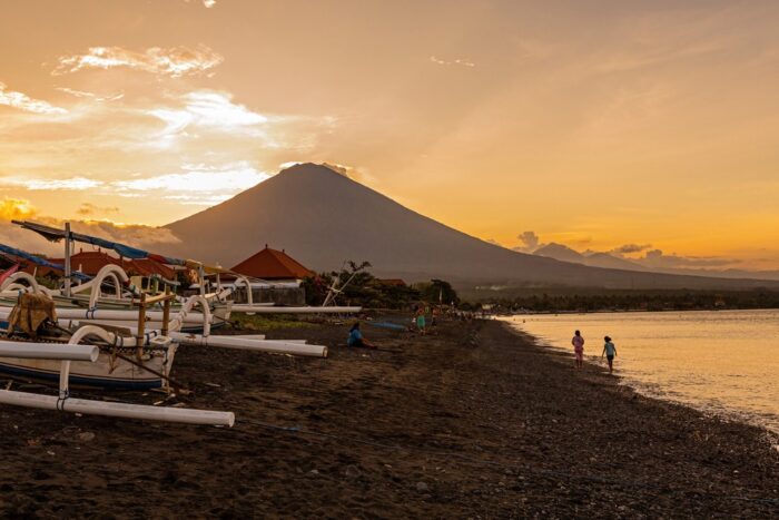
After a physically demanding climb, some travelers appreciate relaxing by the sea. The coastline around Amed is a great choice, where you can unwind without large crowds, go snorkeling, and enjoy views of the volcano you’ve just climbed. Another option for recovery is the Toya Devasya hot springs near Lake Batur.
If you have a bit more time, it’s also worth visiting Besakih Temple. Not only is it one of the starting points for the climb, but it’s also the largest and most important temple complex on Bali.
Conclusion
Climbing Mount Agung is not easy. It’s long, physically demanding, and the weather doesn’t always cooperate. But if you make it to the top, you’ll be rewarded with one of the most beautiful sunrises in Bali.
If you decide to take on the island’s highest peak, feel free to reach out at hello@backindo.com—we’ll be happy to connect you with a trusted local guide we’ve had great experience with.
Continue reading: