
When people think of volcanoes in Indonesia, names like Bromo, Rinjani, Batur, or Merapi usually come to mind. But Mount Tambora often stays under the radar — despite the fact that its 1815 eruption was the most powerful volcanic explosion in recorded human history. The event reshaped global climate, and today, it’s remembered mainly through Tambora’s massive caldera and its imposing summit rising 2,850 meters above sea level.

Climbing Tambora isn’t just another mountain trek. It’s a journey into a remote, rarely visited part of Indonesia, where you’ll find yourself far from the usual tourist crowds. For much of the year, the landscape here is surprisingly dry — almost barren by Indonesian standards — offering a stark contrast to the lush, rain-soaked jungles of other islands.
It’s exactly this mix of isolation, raw nature, and powerful history that draws in the more adventurous kind of traveler.
Getting to Mount Tambora
Mount Tambora is located on Sumbawa Island, in the province of West Nusa Tenggara. While Sumbawa is often seen as just a transit point between Lombok and Flores, the island actually offers vast regions where tourism is still minimal — perfect if you’re looking to experience Indonesia at a slower, rawer pace.

The most common (and logistically easiest) route to Tambora is from the eastern side, starting in the small village of Doro Ncanga. To get there, most travelers first make their way to Bima, a city that serves as the main gateway. There are several ways to reach Bima:
- A short domestic flight (about 1 hour) from Bali or Lombok
- A ferry from Lombok to Poto Tano (West Sumbawa), then overland by car, motorbike, or bus across the island to Bima
- A combination of ferry and bus if you’re coming from Flores
From Bima to Doro Ncanga, you’ll need to arrange transport in advance — there’s no reliable public transportation, and it’s not the kind of place where you can just show up and wing it. The good news is that most guided trekking packages include airport pickup in Bima and return transport, so you won’t have to worry about that part.
Accommodation is available in Bima, Dompu, or right in Doro Ncanga, usually in the form of basic hotels or homestays. Because tourism here is still very limited, it’s essential to book your guide and logistics ahead of time, ideally before you even land on Sumbawa.
The History of Mount Tambora
Before the eruption, Mount Tambora was one of the tallest and most massive volcanoes in the Indonesian archipelago, with a peak reaching over 4,000 meters above sea level. But on April 10, 1815, it exploded with such force that the entire upper part of the mountain collapsed, instantly reducing its height by more than a thousand meters. What remained was a massive collapse caldera, around 7 km wide and over 1 km deep, which still dominates the landscape today.
The eruption devastated the region. It completely wiped out the Tambora Kingdom, burying surrounding villages under meters of ash and pyroclastic flows. Thousands died directly from the blast, and tens of thousands more perished in the following years due to famine, disease, and the long-lasting climate disruption triggered by the eruption.
But the impact didn’t stop at Indonesia’s shores. Tambora’s eruption threw a colossal amount of ash and aerosol into the upper atmosphere, causing global cooling and strange weather across the Northern Hemisphere. The year 1816 became known as “The Year Without a Summer”, especially in Europe and North America, where cold, crop failures, and food shortages became widespread.
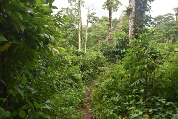
Today, Tambora is part of Tambora National Park, which protects not only the vast caldera but also the diverse landscapes around it. You’ll pass through dry savanna, volcanic slopes, sparse mountain forest, and eventually the wind-exposed rim of the crater. Reaching the caldera’s edge isn’t technically difficult, but it’s definitely one of the most powerful and unforgettable volcanic treks in all of Indonesia.
The Climb to Tambora’s Summit
There are several routes to reach the top of Mount Tambora. If you’re up for a full trekking adventure, you can start from Pancasila village — but be ready for a long, exposed hike through open terrain, with very little shade and lots of sun.
Most visitors choose the more practical route via Doro Ncanga, on the southern side of the mountain. From here, the trip begins with a 4WD ride through dry savanna, which helps skip the toughest and hottest part of the trail. The drive takes you higher up the slope and significantly shortens the hiking portion, which would otherwise be brutal under the open sun.
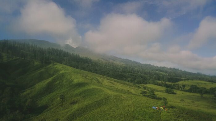
The vehicle typically goes through several checkpoints before reaching Pos 3, a campsite at around 1,800 meters above sea level. This is where hikers rest and spend the night before the summit push. After a light dinner and gear check, it’s early to bed — because the final ascent begins in the middle of the night.
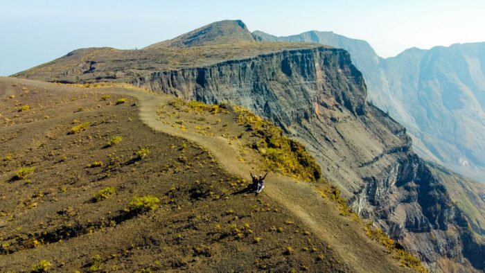
The summit hike usually starts around 3:00 AM, climbing on volcanic ash and gravel, with some steeper sections. As the sky starts to lighten, you’ll reach the rim of Tambora’s giant caldera, just in time for sunrise — a moment that’s hard to forget.
After taking in the views, hikers return to Pos 3 to pack up camp and then head back down the same route to Doro Ncanga. While the entire trip can be done in two days, it does require good fitness, plenty of water, and a reliable local guide who knows the terrain well.
Backindo Tip: Camping inside the caldera or descending down to the crater floor is not allowed — both for safety and conservation reasons.
Practical Info & Tips for Hiking Tambora
Just like with most volcanoes in Indonesia, the best time to climb Tambora is during the dry season (between June and October). During the rainy season, trails become slippery and unsafe, with a higher risk of landslides — and trekking routes are often officially closed by the national park authorities for safety reasons. Access and opening dates can vary each year depending on weather conditions, so it’s important to check in advance.
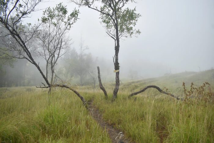
The trek is considered moderate to challenging, mainly due to heat in lower altitudes, dusty volcanic terrain, and the overall length of the route. A local guide is essential — not just for navigation, but also for arranging permits and managing logistics within the national park.
What to Pack
- Sturdy hiking shoes that can handle dry volcanic dust and occasional mud
- Sleeping bag and tent – most guides provide them, but always confirm in advance
- Clothing for both heat and cold – temperatures at the campsites can drop to 5–10°C at night
- Headlamp, insect repellent, sunscreen, basic first aid kit
- Enough water and energy snacks – check with your guide whether food and water are included or if you need to carry your own
- Power bank
Prices & Permits
A 2-day trek with guide, meals, and basic equipment usually costs between IDR 2,000,000–4,000,000 per person. If you’re booking a full package that includes accommodation, jeep transport, and possibly a ferry from Lombok, expect prices to go up to IDR 7,000,000. Don’t hesitate to contact multiple agencies and ask for a personalized quote.
The trek also requires an entry permit to Tambora National Park. The current entrance fee for foreigners is IDR 200,000 per day, but it’s best to double-check the latest price before your trip. In most cases, your guide will arrange the permits for the whole group.
Exploring the Area Around Tambora
Sumbawa is one of Indonesia’s less-traveled islands, making it a great place to combine a volcano trek with quiet beaches or slow, off-the-beaten-path exploration.
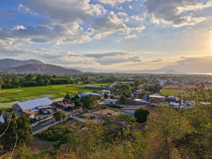
Near Doro Ncanga village, you’ll find open savanna landscapes with free-roaming horses and sweeping views of Tambora. It’s a peaceful spot for short walks, photography, or simply unwinding after the trek.
For ocean lovers, don’t miss Saleh Bay, where whale sharks are known to appear at certain times of the year. Local fishermen offer boat trips for a chance to snorkel or observe these gentle giants up close — though sightings are seasonal and never guaranteed. Another great stop is Moyo Island, famous for its tranquil vibe, waterfalls, and excellent snorkeling and diving.
Moyo Island is best known for its waterfalls — but there’s much more to explore. Discover it all in our full travel guide Moyo Island, Sumbawa: A Complete Travel Guide.

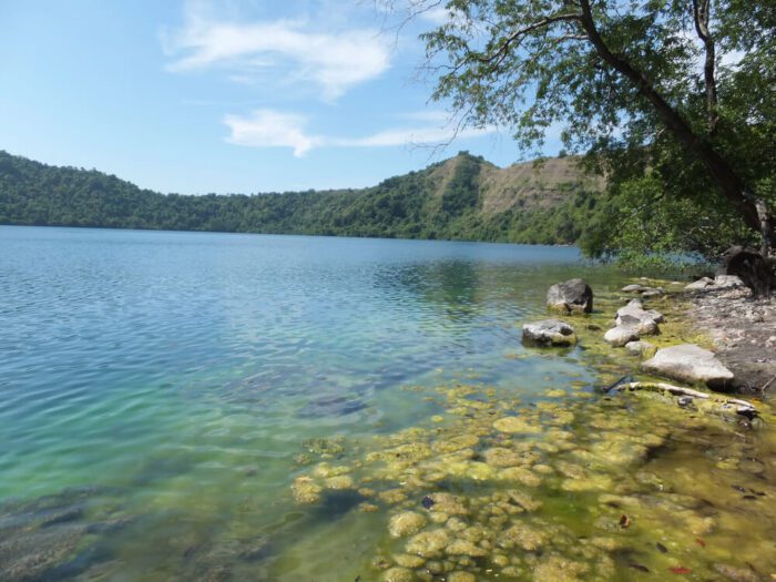
Further north, Satonda Island is home to a unique saltwater crater lake, believed to have gradually shifted from fresh to salty over the years. The island makes for an interesting day trip with volcanic scenery and calm bays.
You can also explore westward toward West Sumbawa and Sumbawa Besar, or go east and continue your journey to Flores. From Sape port, regular ferries cross to Labuan Bajo, the gateway to Komodo National Park. Depending on the season, boats run several times a week — and even daily — making this a well-traveled island-hopping route.
Is It Worth It?
Climbing Mount Tambora takes more time, planning, and cooperation with local guides compared to Indonesia’s more famous volcanoes. But in return, you get something truly special: a trek that’s not just about the summit, but also about moving through a landscape that still feels raw, remote, and real.
For travelers spending more time on Sumbawa — or those heading toward Flores — stop at Tambora makes a lot of sense. It offers a different rhythm of travel: slower, quieter, and blissfully crowd-free.
Continue reading: